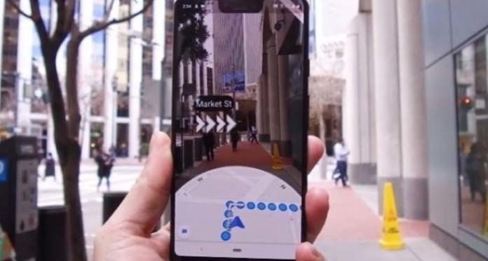
The new Augmented Reality Live View navigation feature is available on the Google Maps app for ARCore/ARKit compatible Android and iOS smartphones. Find out how to use it.
For several months, Google has been testing an augmented reality feature for its Google Maps navigation app. This new AR mode allows to be guided to its destination by virtual arrows superimposed on the real environment of the user filmed by his smartphone.
So far, only a few Google Pixel smartphone users and some high-level “Local Guides” have been able to test this option. Now, this new Live View feature is available in beta for all ARCore compatible Android smartphone users and all ARKit compatible iPhone.
To activate it, nothing more simple. Search for a destination on Google Maps, then press the blue “Directions” button at the bottom of the screen. Choose the pedestrian mode. The “Live View” option will appear at the bottom of the screen. Press this button, and the application will teach you how to use this new tool. Note, however, that the feature is being deployed, and you may need to wait a bit to use it.
Google Maps takes a step ahead of Apple Plans
This new tool will be particularly valuable for people who have already gone in the wrong direction using Google Maps. For good reason, the classic aerial view does not really know for sure in which direction the journey begins. This is particularly related to the fact that the compass of the smartphone can play tricks and get excited, pointing the cursor in the wrong direction. With augmented reality, the problem is definitely solved.
With its new Live View mode, Google Maps takes a step back on Apple Plans. The California apple is also planning to add augmented reality to its navigation application, especially for car journeys, but for the moment it has been content to patent its idea…


